Potosí
 |
 |
Potosí lies at the foot of the Cerro de Potosí —sometimes referred to as the Cerro Rico ("rich mountain")— a mountain popularly conceived of as being "made of" silver ore that dominates the city. The Cerro Rico is the reason for Potosí's historical importance since it was the major supply of silver for the Spanish Empire until Guanajuato in Mexico surpassed it in the 18th century.
The silver was taken by llama and mule train to the Pacific coast, shipped north to Panama City, and carried by mule train across the isthmus of Panama to Nombre de Dios or Portobelo, whence it was taken to Spain on the Spanish treasure fleets. Some of the silver also made its way east to Buenos Aires, via the Rio de la Plata. Some of the silver was also transported to Acapulco, Mexico where they were sent via the Manila Galleons to buy Asian products. Cerro de Potosí's peak is 4824 m above sea level.
Today, Potosí continues to be an important mining center, and is the largest urban center in the Department of Potosí. A growing city, Potosí is now famous for its well-preserved colonial architecture, and unusual geographic setting as the one of the highest cities in the world. It features a rare cold highland climate, and is marked by its long dry period, and short but strong wet season. While famous for its dominance as a mining center in early Spanish colonial history, Potosí still sits at one of the largest silver deposit systems in the world.
Located in the Bolivian Tin Belt, Cerro Rico de Potosí is the world's largest silver deposit and has been mined since the sixteenth century, producing up to 60,000 tonnes by 1996. Estimates are that much silver still remains in the mines. Potosí became the second largest city, and the site of the first mint, in the Americas. By 1891, low silver prices prompted the change to mining tin, which continued until 1985. At peak production in the sixteenth and seventeenth centuries, the ore contained up to 40% silver.
The ore deposits reside in veins present in the dacite volcanic dome. The hill is "honeycombed" with underground workings, reaching from the summit to depths of 1150 m. The conical hill has a reddish-brown gossan cap of iron-oxides and quartz, with grayish-blue altered dacite and many mine dumps below.
Basement rocks consist of Ordovician clastic sediments consisting of phyllite with some sandstone interbedding. At about 13.8 Ma, the dome was extruded. During the explosive process, the Venus breccia formed when the ascending dacite magma reacted with groundwater to produce a phreatic eruption. The released pressure allowed the formation of the Caracoles tuff ring on top of the breccia. The magma then extruded outward from a dike to form a volcanic dome over the tuff. The dacite dome is 1700 m by 1200 m at the surface and narrows down to the 100 m wide dike at depth. Hydrothermal circulation and fracturing soon followed, altering the dacite and depositing ore minerals and gangue in the veins.
Map - Potosí
Map
Country - Bolivia
 |
 |
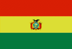
| Flag of Bolivia | |
The sovereign state of Bolivia is a constitutionally unitary state, divided into nine departments. Its geography varies from the peaks of the Andes in the West, to the Eastern Lowlands, situated within the Amazon basin. One-third of the country is within the Andean mountain range. With 1098581 km2 of area, Bolivia is the fifth largest country in South America, after Brazil, Argentina, Peru, and Colombia (and alongside Paraguay, one of the only two landlocked countries in the Americas), the 27th largest in the world, the largest landlocked country in the Southern Hemisphere, and the world's seventh largest landlocked country, after Kazakhstan, Mongolia, Chad, Niger, Mali, and Ethiopia.
Currency / Language
| ISO | Currency | Symbol | Significant figures |
|---|---|---|---|
| BOB | Boliviano | Bs | 2 |
| ISO | Language |
|---|---|
| AY | Aymara language |
| QU | Quechua language |
| ES | Spanish language |


